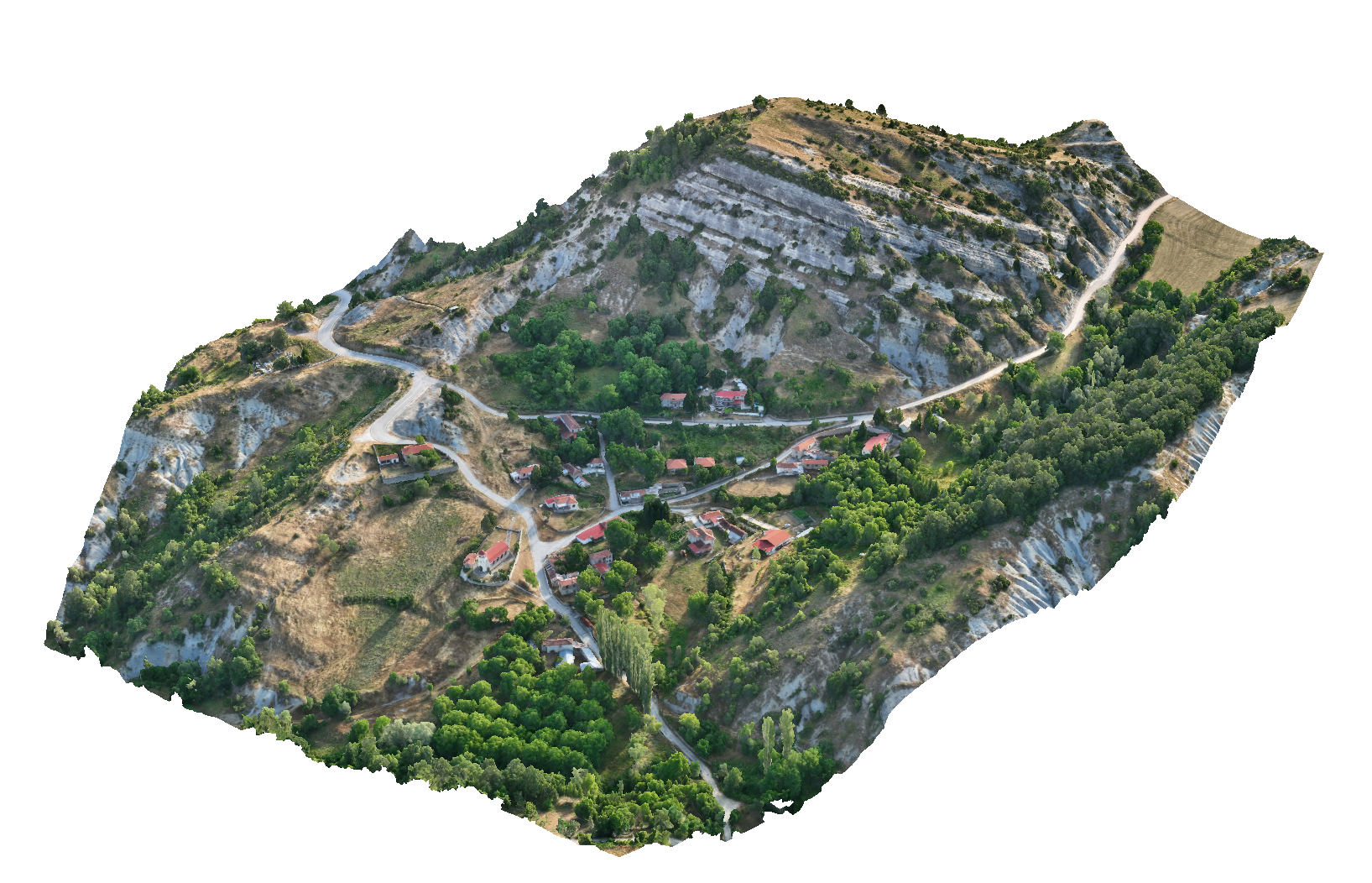
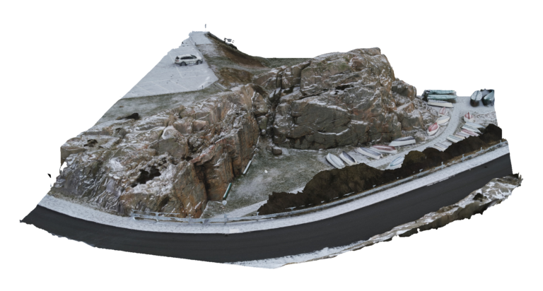
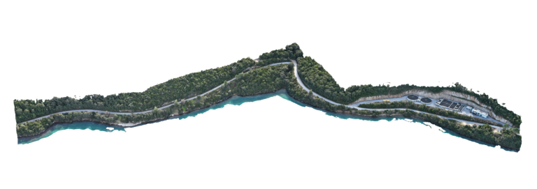
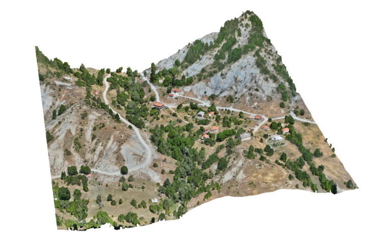
Advantages Using Drone: UAV photogrammetry produces orthomosaics and terrain models that serve as reliable base maps for urban planning studies. These datasets can be directly used in GIS and CAD environments, allowing planners to analyze land parcels, road networks and development patterns with high spatial accuracy.
Deliverables: Interactive 3D model, Orthomosaic, High resolution imagery, Point clouds, CAD deliverables