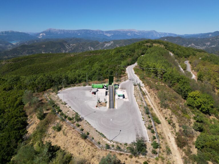
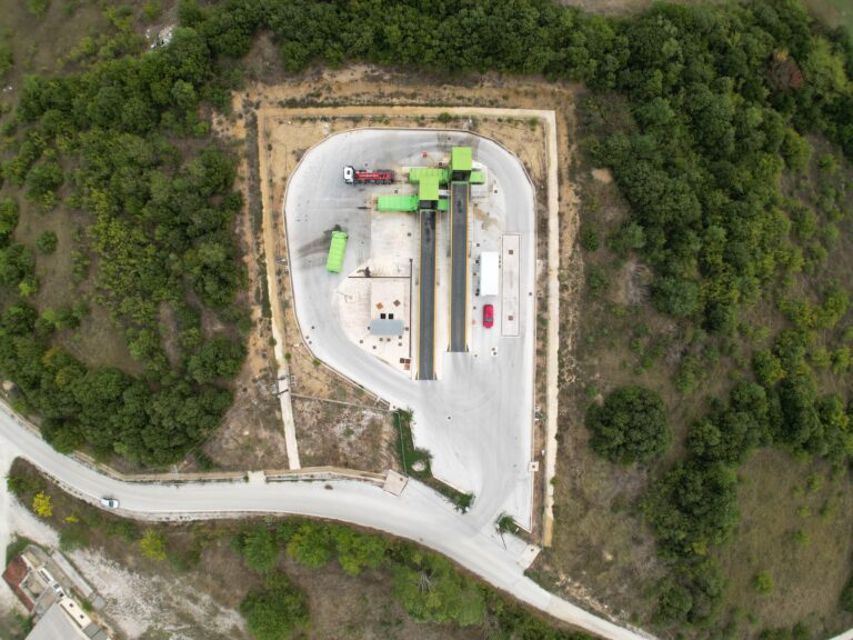
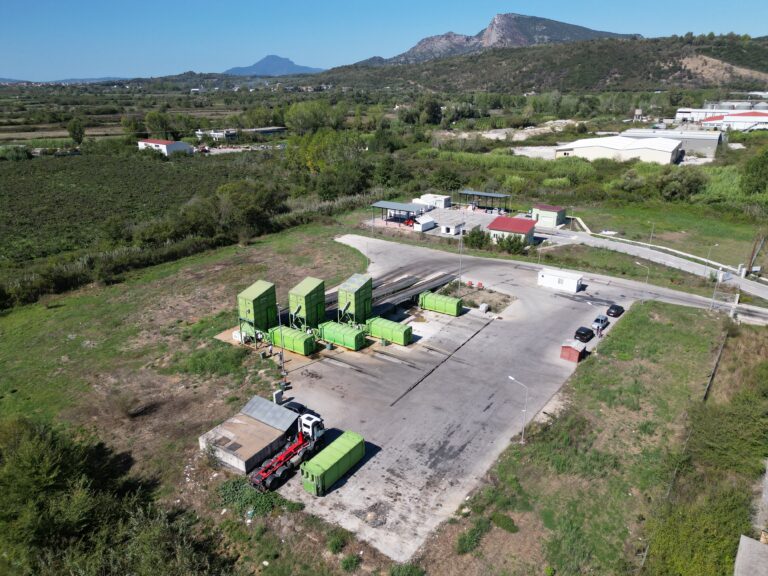
Topo-Drone_Asset & Building Inspections - UAV Mapping for Asset Management – Municipal Waste Facility Mpafras – Epirus
Client: Private Client Sector: Infrastructure
Services Provided: Asset & Building Management
Location: Mpafra – Epirus
Advantages: Drone-derived datasets such as orthomosaics and terrain models provide accurate spatial information that can support future infrastructure planning and facility upgrades. These datasets can be integrated with GIS and CAD platforms, helping municipalities and engineering teams plan expansions, redesign circulation areas or optimize site operations.
Deliverables: Interactive 3D model, Orthomosaic, High resolution imagery, Video